So we
were in Manali, at the end of the tourist season, and we couldn’t find more
people to share a jeep to Spiti
Valley India
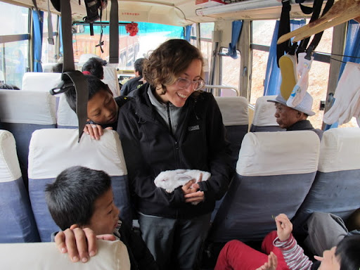
 |
| Local bus |
On the
other side of the green mountains around Manali, we found a pretty impressive
desert mountain valley right before Tibet China
outside the Tibet Tibet
So let’s
go back to the story, we arrived in Kaza at 3800 m above the see level. It’s a
small and dusty place with ugly concrete buildings but it’s the main town and
commercial center of the valley. Besides that, it’s tourist friendly and it has
many guesthouses and tourist restaurants (not that this is a good thing) and
even though there’s no phone signal in most of the valley, there are internet
and call centers. We wanted to start a four day trek in a near village, but we were
informed in a very helpful travel agency that local transportation only got
there twice a week –the day after the following day. Then we went to the
headquarters of ecosphere, a great
initiative from three NGOs (MUSE, SSS and STAG), that promotes sustainable
livelihoods and eco tourism, between other things. They are the guys that
trained the people of the really tiny villages to receive foreigner tourists
and provide them a “home-stay”. They also put signs explaining either about the
villages, or about the solar panels they installed and even how to use a dry-ecological
toilet. There we got some more information and recommendations for our trek from
Komic to Dankhar going through Demul and Lhalung.
Then we sat
at the only bakery. (It was of course a “German bakery”, who knows why they
call the Western bakeries that way). We found ourselves surrounded by Israelis
and an Iranian Jew who was angry that everyone was speaking Hebrew and he
couldn’t understand. In fact, some of the Israelis were complaining –in Hebrew-
that they kept finding Israelis and that it didn’t feel like traveling abroad.
An Israeli couple got interested in our four day trek and wanted to join us;
and two after-army Israelis (which were unlike the ones we met before in Manali
–see the previous
post) offered us to join them in a one day jeep excursion to the villages
of Ki and Kiber the following day.
So at
midday of the following day, the two friends, another Israeli couple that they
met on the way and we traveled by jeep first to Kibber and on the way back to
Ki.
Kiber is
a very small village with around 80 houses and an old gompa (Tibetan monastery);
it’s only 16 kms far from Kaza but 300 meters above it. We wandered around, saw
the monastery and sat in the local restaurant/guesthouse. Ki is an even smaller
village with a huge monastery. We were invited in by a very talkative and
cheerful monk who explained us a little about the monastery and showed us the
room where Dalai Lama once slept. He laughed all the time and from time to time
he talked Gibberish-Hebrew. After the small tour and an optional donation,
which he really earned, he offered us tea and tsampa (balls of roasted barley
flour) and tried to learn his words of the day. He took a brochure from some
NGO and asked us about the meaning of indigenous, provide, support
and autonomous.
 |
| Ki Gompa |
On the
way back to Kaza, the four guys asked us about our four day trek and decided also
to join us.
So the
following day we were supposed to be us and other six people starting the trek.
We ran into the first couple (from the bakery) on the (only) street and they
said some lame excuse about why they’re not coming. That left us six people.
The second couple came to the bus stop to say that they aren’t feeling well;
the girl developed altitude sickness during the night and hardly slept. That
left us four people: us, and Adam and Omer -the two post-army friends
From
Komic to Dankhar

So we
took the local bus around 2 pm and we arrived in our first stop, Komic (4500 m),
one hour and a half later and around 800 meters higher! We were received by
Kunga and his great family in their mud house and gave us a room in the upper
floor with an amazing view. After seeing the stuffed tiger on the entrance of
the local temple and its interior (well, not all of us, Iohi couldn’t enter
because the entrance is forbidden for women – I suspect this is because the
image of guy biting the ass of other guy), we went back to our home-stay. Kunga
prepared Indian food: dal, vegetable curry, rice, pickles and chapattis and
answer all our questions about Spitians and Spiti Valley
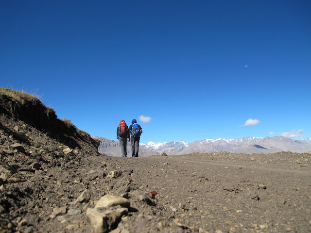
So after
having breakfast and having Kunga’s wife put a lot of rice in our lunch box, we
started to follow up a jeepable road under the bright sun of 4000+ altitude. We
were alone most of the time walking up on a moon-like landscape and we only saw
far away some shepherds. At that height walking with our bags, water and food
was a pretty hard task, but eventually we found some Spitians on motorbikes
that point us that the trail to Demul went up from the jeep path across the
mountain. Then every step was an excruciating task, we had headaches on and off
and even breathing was tough. After 4 hours we were thrilled to see the Tibetan
prayer flags that marked the highest point of the trail: 4700 m above sea level.

From
there it was a nice and relieving walk down. After one hour or less we started
to sea the terraces with plantations of barley, potatoes and wheat, and the
people working the land with yaks. Soon we arrived at Demul (~4300m), mud
houses on a steeped slope and everyone, men and women, was singing and working.
We still don’t understand what they did; they were moving, splitting and all
sort of stuff with dried straws.
 |
| Demul |
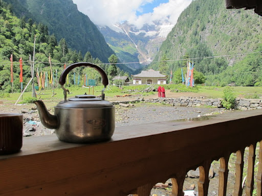
 |
| Inside the homestay |
On the
following morning, we headed to what supposed to be the shorter trekking day –4
or 5 hours. So we started an extremely stepped walk down the valley; in less
than 2 hours we descended around 1000 meters! First we went down a river until
we reached a village of five mud houses called Sanglung. We had there some nice
trees to have our lunch (box) and then we peeked in a house until we were
invited to have some chai with the local family. We asked regarding our next
destination, Lhalung, and the guy from the family did a single hand-movement
that pointed down towards the river bank and then west. We were a little
puzzled, our printed instructions (from 2008) indicated that the path goes east
and then down the river to cross a bridge and then up again to reach Lhalung.
So we
went down till almost the river and asked again to a group of workers who
pointed east (like our printed instructions). Since we didn’t want to walk up
again to the trail, we went off the path and walked over the river bank towards
the east. We supposed that we’ll eventually find the bridge right there over
the water…
So we
walked and walked off the path over the stones and mud on the northern shore of
the river for hours. Suddenly we had Lhalung up the hill in front of us, and on
the other side of the river. But the thing was, there was no bridge…
We
considered many times to cross the river but we weren’t sure how dangerous that
could be. So we walked again up and down the river looking for a quieter spot,
but the current seemed pretty strong everywhere. The idea of crossing the water
vanished when Iohi put a toe in the freezing cold water and we decided just to
go back.
 |
| Lhalung and below the river we wanted to cross |
So we walked
to the west all the way back to Sanglung and then continued until we finally
saw a bridge. We crossed it and we walked again to the east, this time on the
right side of the river. So after 9 hours walking, and just before the sunset, we
entered in Lhalung (~3700 m). This little village in the middle of nothing had several
home stays, even with signs. We opted for Khabric Guesthouse, where we collapsed
on the kitchen floor and drank tea until the evening. We were hosted by the
magnificent Tashi and his family, and he explained us that the bridge we were
looking for on the east was washed away with the last rains.
Iohi had
the chance to master her technique in momo making by helping with the dough together
with Tashi’s little girl and we enjoyed of Tashi’s family’s company.
 |
| Iohi mastering the momo making technique with Tashi's |
daughter
On the
morning we walked four and half hours to Dankhar (~3800 m). Dankhar is the most
touristic town of that area, but we found it the least interesting. It’s nice
when you see it from far, the monasteries and the fort on the steeped mountain
over a precipice. But when you get there, it’s only OK. Every other village on
our way was much nicer and interesting.
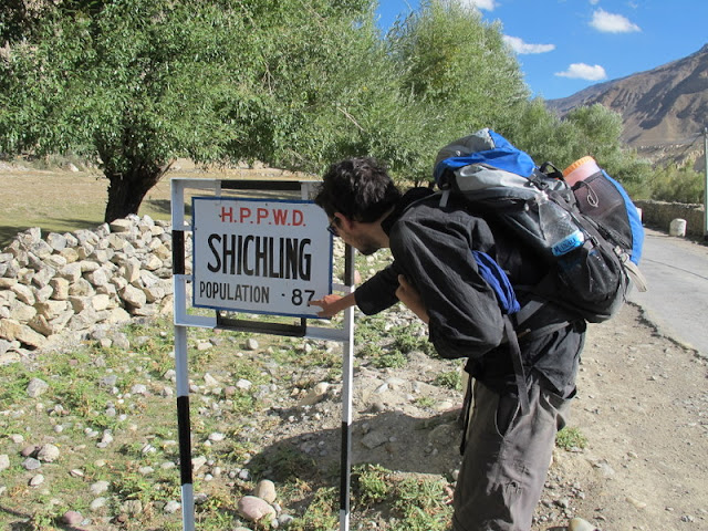 |
| Shichling village below of Dankhar, on our way to the bus stop |
Back
to Kaza, back to Manali
So we
traveled from Kaza to Manali again by local bus. But this time the drive was a
nightmare, the bus was very crowded, when 2 people got down, 5 got in. I even
got in a quarrel with a Tibetan monk because of Iohi’s seat. I ended up on the
back part of the bus with more people than seats breathing all the dust that
entered from the open windows.
We
stayed for a day in Manali, and then we traveled to Dharamshala to meet Iohi’s
sister, Sachu.
On the
following morning, we took a minibus to Upper Dharamshala ,
also known as McLeod Ganj, and also known as where the Dalai Lama lives…
Pictures of Spiti in Iohi's picasa